
A civic and religious landmark
Masjid Agung Al Faruq anchors a visit to Bukit Pelangi. Appreciate its architecture as a guest in an active place of worship, following the community’s access guidance.


Sangatta rewards a closer look at its everyday spaces: the mosque and public hilltop at Bukit Pelangi, a neighbourhood polder and the coastal edge at Kenyamukan. Spend two unhurried days in the town itself, with time for local food businesses rather than treating every attraction in Kutai Timur as a nearby stop.
129,849 residents in Sangatta Utara district · second half of 2025 · not an exact urban Sangatta count
Masjid Agung Al Faruq anchors a visit to Bukit Pelangi. Appreciate its architecture as a guest in an active place of worship, following the community’s access guidance.

The public hilltop and its mining display offer a local introduction to Sangatta’s working identity. A retired machine in a public setting is different from access to an operating mine.

Kenyamukan gives a town stay a coastal dimension. Visit the beach area under current local conditions; do not confuse it with a promise of passenger services from the neighbouring port project.

Visit Sangatta’s Al Faruq mosque in Bukit Pelangi as an active religious place, not simply an architectural backdrop.
Explore further
Take a short walk around Sangatta’s public polder, where water-management infrastructure also forms a neighbourhood meeting place.
Explore further
Explore the public Bukit Pandang setting in Bukit Pelangi, with a mining-machine display that connects leisure space and Sangatta’s working identity.
Explore further
Visit Sangatta’s Kenyamukan coastal edge as a separate local outing, keeping beach access distinct from the neighbouring port development.
Explore further
A larger hotel on Jalan Pendidikan, offering a full-service alternative to Sangatta’s smaller guesthouses.
Affiliate linkBekijk beschikbaarheid op Agoda
A budget hotel in Sangatta for travellers seeking a straightforward room rather than a larger resort.
Affiliate linkBekijk beschikbaarheid op Agoda
A hotel on Jalan Yos Sudarso I, on Sangatta’s established commercial corridor.
Affiliate linkBekijk beschikbaarheid op Agoda
A budget option on Jalan Murung Raya in Swarga Bara, away from the main Yos Sudarso corridor.
Affiliate linkBekijk beschikbaarheid op Agoda
A local hotel on the southern road into Sangatta, useful for visitors arriving overland from Bontang.
Affiliate linkBekijk beschikbaarheid op Agoda
A small guesthouse in Teluk Lingga, offering an alternative to Sangatta’s larger business hotels.
Affiliate linkBekijk beschikbaarheid op Agoda
Bukit Pelangi places Sangatta’s administrative role visibly in the landscape. Government buildings, Al Faruq and public spaces belong to the town’s everyday setting, while the retired mining display at Bukit Pandang recalls another part of its working identity. Explore the areas genuinely open to visitors without treating offices or industrial sites as attractions with automatic access. A civic skyline is context: it helps explain the place, but it does not turn a whole regency into one compact city.
Explore further
The Sangatta River and the coast give the town a water-based setting, while Polder Ilham Maulana makes water management visible in public life. These are different waterscapes: a river, a coastal edge and a managed retention basin should not be treated as interchangeable recreation grounds. Look from permitted public spaces, respect working boats and do not assume a waterfront view means a scheduled cruise is available. The most rewarding pause may simply be noticing how routes, homes and work meet the water.
Explore furtherLocal dishes and everyday food traditions.

Read a documented Sangatta food encounter through nipah-leaf ketupat, a shared regional tradition rather than an exclusively local invention.
Explore further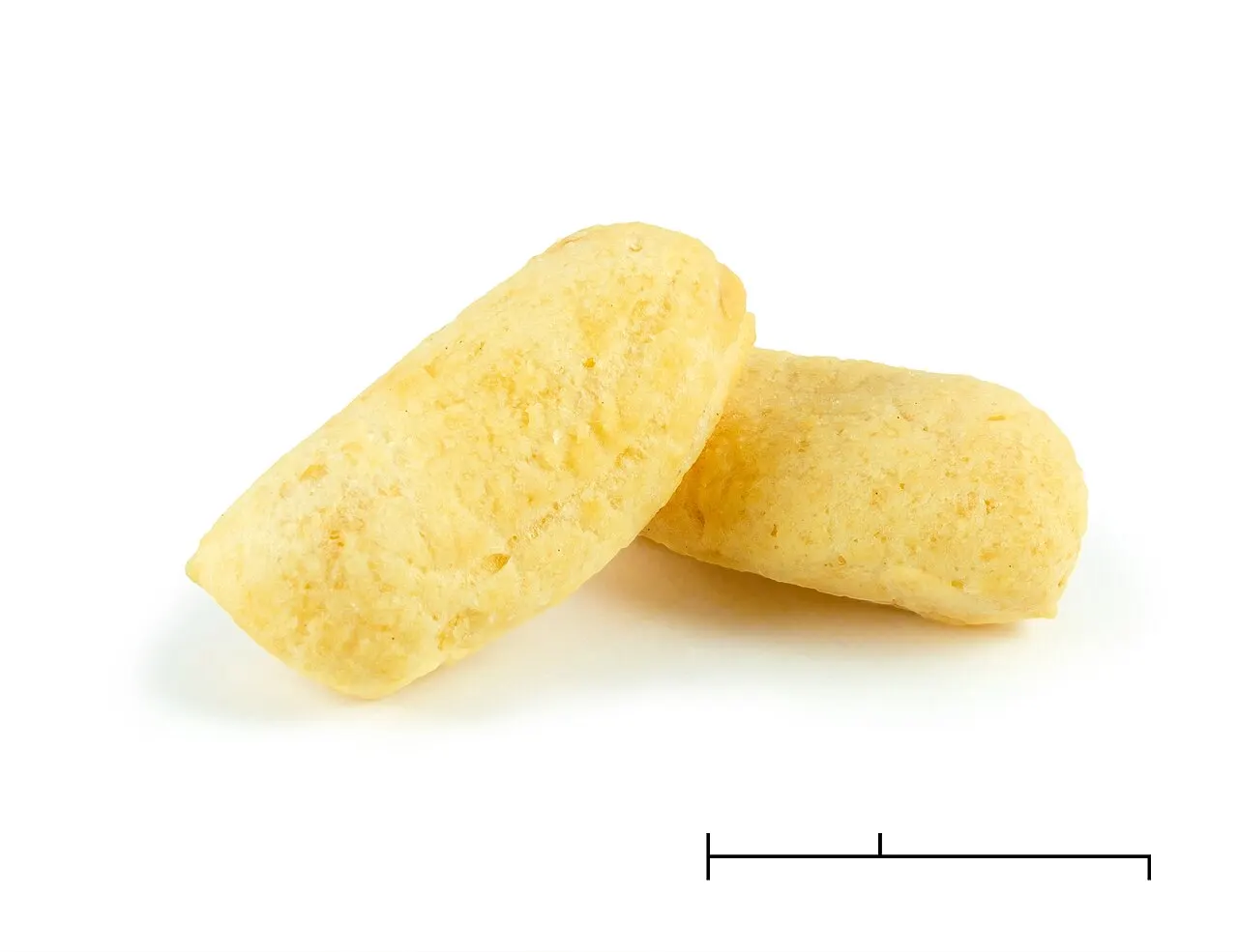
Amplang is a crisp fish cracker associated with East Kalimantan, especially familiar as a snack and take-home food. Its appeal lies in the combination of a light crunch and…
Explore further
Explore a real local food-business area in Sangatta, checking the stalls and menu available during your visit.
Explore furtherCompare flights to Aji Pangeran Tumenggung Pranoto Airport near Samarinda, then arrange the separate road journey to Sangatta.
Explore furtherGroup Bukit Pelangi visits together and use separate road transfers for the polder and Kenyamukan.
Keep coast and outdoor walks flexible around rain, heat and current access.
Respect worship, public-space users and working areas; confirm prices and access before making a special journey.
Sangatta is the administrative centre of Kutai Timur, not an autonomous municipality covering the whole regency. Its urban planning area crosses parts of Sangatta Utara and Sangatta Selatan. This guide concentrates on the town’s public spaces and nearby Kenyamukan coast; it does not turn distant regency attractions into local stops. Population figures must be read with their stated administrative boundary.
Visit Al Faruq when visitors are admitted, then continue to the public Bukit Pandang area. Pause over food if stalls are operating and keep the day centred on these local spaces rather than adding a distant mine or forest excursion.
Take a short walk at Polder Ilham Maulana, then make a separate road visit to Kenyamukan if weather and access are suitable. Leave room for a local food purchase and the onward journey. Do not rely on an unconfirmed passenger departure from the port.
From a first idea to your own Borneo journey.
History, culture and the practical details that make a visit richer. Open a chapter to read the complete guide.

Sangatta rewards a closer look at its everyday spaces: the mosque and public hilltop at Bukit Pelangi, a neighbourhood polder and the coastal edge at Kenyamukan. Spend two unhurried days in the town itself, with time for local food businesses rather than treating every attraction in Kutai Timur as a nearby stop.
Bukit Pandang brings a retired mining machine into the public landscape of Bukit Pelangi. It offers a tangible starting point for understanding why mining appears in Sangatta’s identity, without turning a town visit into an industrial tour. Look at the machine as a displayed object and keep the surrounding public space accessible to other visitors. Active mining sites, offices and operational roads have different rules and should not be entered because a monument has made the subject familiar.
Sangatta is the administrative centre of Kutai Timur, not an autonomous municipality covering the whole regency. Its urban planning area crosses parts of Sangatta Utara and Sangatta Selatan. This guide concentrates on the town’s public spaces and nearby Kenyamukan coast; it does not turn distant regency attractions into local stops. Population figures must be read with their stated administrative boundary.

Polder Ilham Maulana was designed to hold water and help manage flooding, yet its public edges have also become part of Sangatta’s leisure routine. A short walk shows how practical infrastructure and social life can share a place. It is not a natural swimming lake. Stay on open routes, respect barriers and let current conditions determine how much of the edge to explore. A modest pause here can reveal more of everyday town life than a hurried checklist of distant scenery.
Use the local forecast and site conditions when choosing the day’s programme. Midday heat can make exposed public spaces tiring, while rain changes footing at the polder and the coastal edge. The polder is water-management infrastructure as well as a recreation space; do not approach restricted edges during heavy rain. At Kenyamukan, follow local warnings and do not infer swimming safety from a beach photograph. Religious events can change access around Al Faruq, so confirm arrangements without promising a fixed festival date. Leave room to move a stop instead of completing an itinerary at any cost.

Amplang has a documented Sangatta connection through local small businesses, including the product marketed as amplang batu bara. The name is a local product identity, not a reason to invent ingredients or claim that fish crackers originated only here. Check the actual producer and label when buying.
For a meal, Bukit Pandang offers a documented local food-business setting rather than a single invented city speciality. Ask what is being cooked that day and check ingredients directly.
Nipah-leaf ketupat is also documented in Sangatta: a dated local meal photograph and university research about regional producers establish that connection. It belongs to a shared tradition, not an exclusive city invention. Confirm present-day availability and never assume the photographed historic stall still operates.

Sangatta’s visitor stops are spread across different parts of the town. Bukit Pandang and the mosque belong to the Bukit Pelangi visit, while Polder Ilham Maulana and Kenyamukan need separate routing. Arrange a vehicle with exact meeting points and ask your accommodation about current return options rather than assuming a taxi will be waiting. Walk only the accessible public sections of each site. Do not plan a continuous coastal promenade or a passenger boat connection simply from a map. Kenyamukan’s port development is separate from beach access, and neither establishes a scheduled visitor ferry.
At Al Faruq, follow dress and footwear instructions and ask which areas are open to visitors. Public parks also serve residents exercising, socialising or working, so keep paths clear and ask before portraits. A mining machine displayed at Bukit Pandang does not authorise climbing or access to a working mine. Carry drinking water and a rain layer. For food purchases, check ingredients, freshness and the actual price with the seller. A plan for future facilities, a past festival or an old photograph should never be treated as proof that a service is operating today.
Loading this map connects your browser to Google. Google receives your IP address and browser information and may use cookies under its own privacy policy. This choice applies only to this map until you leave or reload this page; it does not enable Analytics.
simas.kemenag.go.id · 01.2.23.05.04.000001
pro.kutaitimurkab.go.id · mobil hias bakal meriahkan pawai takbir di sangatta
pro.kutaitimurkab.go.id · oktober 2026 wajib halal bpjph kutim intensifkan pendampingan umkm
pro.kutaitimurkab.go.id · libur lebaran warga sangatta serbu pantai kenyamukan
pro.kutaitimurkab.go.id · kutim hadapi momen mudik lebaran 933 personel gabungan disiagakan
pro.kutaitimurkab.go.id · pemkab kutim targetkan pelabuhan kenyamukan beroperasi awal 2028
commons.wikimedia.org · File:Ketupat_nipah_110317 13487_sagt.JPG
commons.wikimedia.org · File:Coto_makassar_110317 13480_sagt.JPG
repository.unmul.ac.id · 151 File%20Utama%20Naskah 1195 1 10 20220628.pdf
www.kaltimkreatif.id · TALANPEKDA KALTIM 2021 2025.pdf
www.indonesia.travel · east kalimantan
repository.unmul.ac.id · Kuliner%20Borneo_v.2.0_FULL%20ISBN%20%281%29.pdf
peraturan.bpk.go.id · perbup kab kutai timur no 23 tahun 2022
rpd.kutaitimurkab.go.id · buyer dari sabah malaysia kunjungi sangatta untuk ekspor amplang batu bara
pro.kutaitimurkab.go.id · ini dia amfs menjelma jadi destinasi ekowisata baru di sangatta
Masjid Agung Al-Faruq.JPGEzagren · Wikimedia Commons · CC BY-SA 4.0 · Cropped · Original
Masjid Agung Al Faruq Sangatta (1).jpgSri Wahyuni Nur Indah Sari; Erlyndita Setyawardani; Fandy Aprianto Rohman · Wikimedia Commons · CC BY-SA 4.0 · Cropped · Original
Taman Bukit Pandang Indah.JPGEzagren · Wikimedia Commons · CC BY-SA 4.0 · Cropped · Original
Pantai Kenyamukan (1).jpgErlyndita Setyawardani and Fandy Aprianto Rohman · Wikimedia Commons · CC BY-SA 4.0 · Cropped · Original
Bagian Dalam Masjid Agung Al Faruq Sangatta (3).jpgSri Wahyuni Nur Indah Sari · Wikimedia Commons · CC BY-SA 4.0 · Cropped · Original
Polder Sangatta.JPGEzagren · Wikimedia Commons · CC BY-SA 4.0 · Cropped · Original
Dump Truck di Bukit Pandang (1).jpgKinanthi Nugroho · Wikimedia Commons · CC BY-SA 4.0 · Cropped · Original
Pantai Kenyamukan (2).jpgErlyndita Setyawardani and Fandy Aprianto Rohman · Wikimedia Commons · CC BY-SA 4.0 · Cropped · Original
Kantor Bupati Kutai Timur.JPGEzagren · Wikimedia Commons · CC BY-SA 4.0 · Cropped · Original
Sungai Sangatta (1).jpgKinanthi Nugroho · Wikimedia Commons · CC BY-SA 4.0 · Cropped · Original
Ketupat nipah 110317-13487 sagt.JPGWibowo Djatmiko (Wie146) · Wikimedia Commons · CC BY-SA 4.0 · Cropped · Original
Amplang photographed in Kotabaru, South Kalimantan; the snack is also associated with East Kalimantan.Crisco 1492 · Wikimedia Commons · CC BY-SA 4.0 · Cropped · Original
Taman Bukit Pandang Sangatta.jpgKinanthi Nugroho · Wikimedia Commons · CC BY-SA 4.0 · Cropped · Original
Patung Burung Enggang Sangatta (03).jpgKinanthi Nugroho · Wikimedia Commons · CC BY-SA 4.0 · Cropped · Original
Pantai Kenyamukan (6).jpgNerissa Lyra · Wikimedia Commons · CC BY-SA 4.0 · Cropped · Original
Jembatan Sangatta.jpgKinanthi Nugroho · Wikimedia Commons · CC BY-SA 4.0 · Cropped · Original
Monumen Kudungga.JPGEzagren · Wikimedia Commons · CC BY-SA 4.0 · Cropped · Original
Kenyamukan mangrove shoreline and wooden jettyNerissa Lyra · Wikimedia Commons · CC BY-SA 4.0 · Cropped · Original
Tongkonan Sangatta (1).jpgPius Krisnadi · Wikimedia Commons · CC BY-SA 4.0 · Cropped · Original
Masjid Agung Al Faruq Sangatta Kutai Timur (5).jpgSri Wahyuni Nur Indah Sari · Wikimedia Commons · CC BY-SA 4.0 · Cropped · Original
Seafront of Balikpapan.Ezagren · Wikimedia Commons · CC BY-SA 4.0 · Cropped · Original
Horizon Bontang Kuala (1).jpgSri Wahyuni Nur Indah Sari · Wikimedia Commons · CC BY-SA 4.0 · Cropped · Original


