
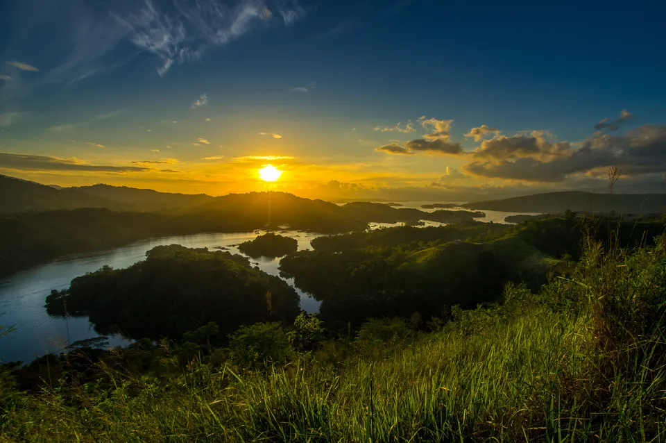
A viewpoint over a reservoir landscape
Bukit Matang Kaladan rises above the Riam Kanan reservoir at Tiwingan Lama in Aranio, South Kalimantan. The hill offers a distinct land-based view of the small islands and surrounding water. This is a human-made reservoir, not a coastal archipelago, and the wider landscape carries both geological and settlement history. The Meratus Geopark’s eastern route uses the viewpoint to help explain that setting. A separate visit is worthwhile for the ascent and changing perspective, without needing to organise a boat trip merely to see the view.
The climb is part of the visit
Local government describes an uphill path with steep sections, steps and simple supports. Published ascent times vary, so let your fitness, the ground and the weather set the pace instead of aiming for a fixed number of minutes. Ask local staff which route is currently usable and whether any part is restricted. Wear footwear with grip and carry water; do not assume a short hill is an effortless walk. At the viewpoint, enjoy the broad landscape without stepping beyond safe visitor areas for a photograph.
Approach through Tiwingan Lama
Use the Tiwingan Lama reservoir-pier area as the local approach and confirm visitor parking and the hill entrance with the managing tourism group. The regency visitor system lists the site as open and provides a local management contact. Banjarbaru is a wider city base, while Martapura lies within the broader approach region. Tiwingan Lama should not be confused with Tiwingan Baru: similar village names do not make them the same entrance or destination. Arrange return road transport and ask about current admission and path conditions before setting out.
Allow time without adding an unconfirmed programme
Allow roughly two to three hours on site as a planning suggestion, including climbing, rest and the descent; travel time is additional. If you want a reservoir boat outing, organise it separately rather than assuming it comes with the hill visit. Do not rely on old admission prices or listings of facilities still described as forthcoming. Sunrise, camping and motorcycle assistance need their own current local confirmation, not an assumption based on a photograph. Rain can change footing, and turning back remains a sensible choice when conditions do not suit the group.
